Suche einschränken:
Zur Kasse

239 Ergebnisse - Zeige 1 von 20.

Castles Map of Scotland

Collins Maps / Tabraham, Chris
Castles Map of Scotland
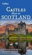
Discover Scotland's ancient monuments and castles.Explore Scotland¿s ancient monuments with this pictorial map featuring over 700 castles and fortified houses. Includes an easy-to-use index listing visitor information and an attractive selection of photographs.

CHF 15.50

Scotland Touring Map

Collins Maps
Scotland Touring Map
Explore new places with this up-to-date map of Scotland.Best-selling map of Scotland. More than 1, 000 places of tourist interest plotted and named on the map. The features have been plotted onto an up-to-date and attractive Collins map of Scotland.

CHF 14.50

Collins Student Atlas

Collins Maps
Collins Student Atlas
The perfect GCSE Atlas to get ready to go back to school.Fully revised and updated for 2024, this curriculum-supportive world atlas is the perfect tool for students aged 14-16 years (Key Stage 4, GCSE 9-1).

CHF 19.90

Edinburgh Pocket Map

Collins Maps
Edinburgh Pocket Map
Explore new places with handy pocket maps from Collins.Handy little full-colour map of central Edinburgh with a high level of detail. Clear mapping from Leith in the north to The Meadows in the south, and Edinburgh Zoo in the west to Holyrood Park in the east.

CHF 8.50

Discovering Paris Illustrated Map

Collins Maps
Discovering Paris Illustrated Map
Explore new places with dependable maps from Collins.With its use of delightful water-colour mapping and individual paintings of all the main sights and landmarks, this illustrated map of Paris is both a useful guide to the city and a handy souvenir!

CHF 14.50

Road Atlas Ireland

Collins Maps
Road Atlas Ireland
Explore Ireland with this accurate and fully updated road atlas. Road atlas, at A4 size, covering the whole of Ireland featuring clear and detailed Collins colour mapping at a scale of 5.2 miles to 1 inch. Perfect for both residents and visitors touring Ireland.

CHF 13.90

Map of Ireland Handy

Collins Maps
Map of Ireland Handy
Explore new places with this authoritative map of Ireland. Easy-to-use route-planning map covering the whole of Ireland opens almost like a book. It has the convenience of an atlas with all the benefits of a fold out map, and features clear, full-colour road maps at 10 miles to 1 inch plus city centre plans of Belfast and Dublin.

CHF 13.50

Thames Path National Trail Map

Collins Maps
Thames Path National Trail Map
Perfect guide and map for planning your adventure along the Thames Path. Part of the National Trail network, this long distance footpath covers 184 miles (296 km) and follows the length of England's longest river, the Thames, from its source in the Cotswolds to the Thames Barrier in Greenwich, London.

CHF 15.50